


The Age of Precision Agriculture
Artificial Intelligence, Neural Networks, Machine Learning - The Future of Agriculture is Here.
Key management personnel and board members of plantation companies rely on ground personnel and processes to relay accurate information and understanding of their businesses.
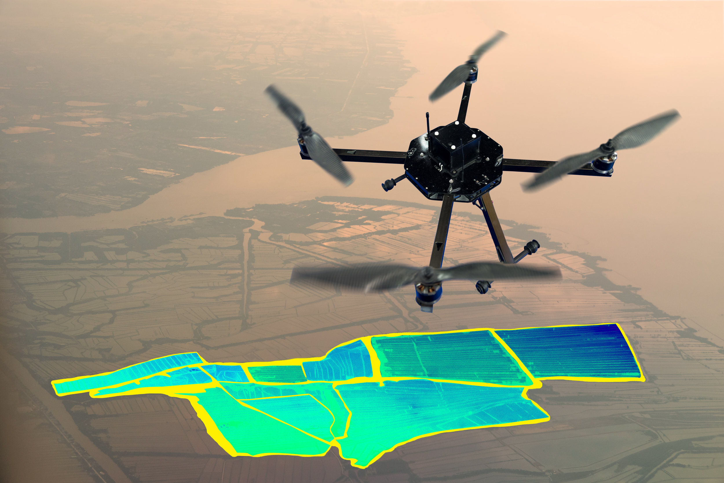
Our Eye of Gaia suite of digital agriculture services provides direct and instant access to information of an estate's operations utilising several technologies including UAV and Satellite systems. The insights obtained is fed into matrices and translated into executive reports for the top management so that they always have their eyes on the ground.

Digital Agriculture is Precision Agriculture
With the proliferation of drone technology, aerial agronomy’s cost of investment versus returns is starting to turn over. BPP/A’s team of GIS experts work closely with their Agronomy counterparts offering a multidiscipline approach to Agronomy utilising the latest technology.
The benefits of aerial mapping are:
Make informed decisions about investment in new land
Define plantable / unplantable area
Planning of blocks and related infrastructures (terraces, roads, drain, etc.)
Minimize planning errors / minimize wastage of funds
Identify HCV, water catchment, settlement and other surrounding land cover
Estimate land compensation costs
Overlay government's right to cultivate area, forestry and protected area maps
Advances awareness of problematic areas

Step into the 21st century of Planning & Analysis with BPP/A Digital Ag's EYE OF GAIA
BPP/A provides Mapping and hectare verification as well as aerial photography for various precision agriculture requirements (including verification of stand per hectare on a periodic basis), including:
2D & 3D mapping
Map digitization
DSM (Digital Surface Model) & DEM (Digital Elevation Model) generation for various purposes such as contour map.
Palm count (for determination of palm stand per hectare)
Road & Drain network measurement
Land Use Analysis extraction (features identified by aerial photo) from the processed UAV captured images. land use analysis will shed light on matters such as verification of boundaries (to ensure agriculture projects are confined within legally permitted boundaries & avoid encroachment into HCV areas), determine location of surrounding villages, identify roads & rivers and determine topography (slope & contour) of the specified areas - all of these are important & useful for RSPO certification.
Detail Block and Estate Map (Year of planting, planted and unplanted Ha)
Our Professional Engagements in 2017

40,000 ha of UAV aerial surveys and mapping of oil palm plantations in Malaysia & Indonesia.
Be prepared for the future of Agriculture
For a full presentation of our services write to us at digital@bpp.ag
